Showing posts with label Pacific. Show all posts

Monday, May 4, 2015

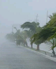
Mar del Fondo Produces Three Meter Waves, Floods Road

Despite the red flags, dozens of beachgoers entered the treacherous water.
The annual mar del fondo oceanic phenomenon is causing havoc along Pacific coastal areas prompting the Federal government to post alerts in Sinaloa, Baja California Sur, Nayarit, Jalisco, Colima, Guerrero, Oaxaca and Chiapas.
Its affects have been felt in Mazatlán since Saturday when lifeguards closed all beaches. Despite the red flags, dozens of beachgoers entered the treacherous water where three meter waves with strong undercurrents pounded the normally tranquil beaches.
Waves flooded access walkways in the Zona Dorada beside the Inn at Mazatlán and south of the El Cid hotel towers.
Waves have been pounding up against and breaching retaining walls of hotels and private residences flooding access walkways in the Zona Dorada beside the Inn at Mazatlán and south of the El Cid hotel towers. Flood waters reached Av. Camarón Sábalo where traffic was forced to slow down to wade through the overflow.
Mazatlán’s Port Captain closed navigation for small boats including sports fishing and recreational boating. Juan Romero of the Office of the Port Captain said the closure could be in effect until tomorrow (Tuesday) when they would re-evaluate the situation.
The Secretary of National Defence stated Acapulco and Coyuca de Benítz in Guerrero have suffered the most damage from the mar del fondo. There a total of 218 homes were damaged, one person died and another disappeared.
The National Meteorological Service advised the oceanic phenomenon would continue for another 48 hours.
(from Noroeste)

Wednesday, February 11, 2015

Maz Fishermen Rescue Hot Air Balloon Pilots

by Maureen Dietrich
10 Feb 15
mazmessenger.com

Mazatlán fishermen aboard the Paúl I shrimp trawler saw the balloon go down.


After breaking two world records for hot air balloon flights, American Troy Bradley and Russian Leonid Tiukhtyaev were rescued by Mazatlán fishermen aboard the Paúl I shrimp trawler when the balloon was forced into the sea by bad weather off the coast of Los Cabos, BCS.

On Saturday, January 31st this year at 7,000 nautical miles from the coast, the crew of the trawler spotted the balloon as it fell into the sea and rushed to rescue the two pilots who were aboard their yellow safety capsule beside the collapsed balloon.

The capsule had turned over, said crew member Abraham Trujillo. They calmed the pilots, took them aboard and went into the water to recover everything, including the balloon.


The two pilots were aboard their yellow safety capsule beside the collapsed balloon.


The American was shaken up when rescued and was attended to.

One crew member told media that four and a half hours later ships from the Mexican Navy arrived to take over.

Pilot Troy Bradley and his wife, who flew in from Alburquerque, New Mexico, are presently in Mazatlán to collect the safety capsule, part of the balloon and communications equipment.

The two pilots had recently broken the records for hot air balloon voyages by travelling 10,700 kilometers and remaining airborne for a total of 160 hours.

(from Noroeste)

Thursday, January 8, 2015

Mexico inaugurates Interocean Gas Pipeline to link the Gulf of Mexico to the Pacific Ocean

theyucatantimes.com

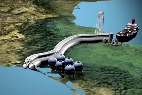
A new natural gas pipeline will soon be fully operational south of the border where a new energy project will link production fields in the Gulf of Mexico to shipping yards in the Pacific Ocean.
Mexican President Enrique Peña-Nieto and other dignitaries traveled to Salina Cruz, Oaxaca, to inaugurate the project on Friday, January 2nd.
Peña-Nieto was on hand to open an interocean natural gas pipeline and oversee the beginning of construction of a fleet of ships for the project.
Mexico inaugurates interocean gas pipeline (Photo: PEMEX)
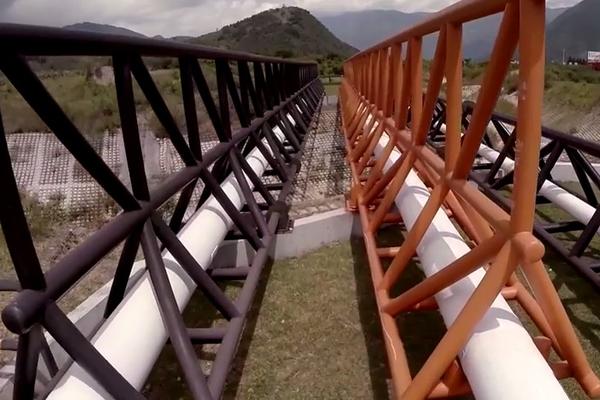
The natural gas pipeline extends 310 miles from Jaltipan, Veracruz (on the Gulf of Mexico), to a refinery in Salina Cruz, Oaxaca (on the Pacific Coast), according to Mexico’s national oil company Petróleos Mexicanos (PEMEX).
The $6 billion dollar project will reduce time required to move natural gas from productions areas in the Gulf of Mexico to the refinery from 16 days to seven. (See video below describing the project; disclaimer — it’s in Spanish.)
According to project plans, the interocean pipeline also eliminates the need for ships to use the Panama Canal and will quickly move natural gas to a fleet of ships that will take it to lucrative markets along the Pacific Ocean in Asia, North America and South America.
Pemex Pipeline (Image: PEMEX)
The inauguration comes at a time when gas prices have hit their lowest point in several years time.
Mexico recently opened its nationalized oil industry to foreign investment.
Pemex pipeline (Photo: PEMEX)
Nelson Balido with the San Antonio-based Energy Council of the Americas recently told the San Antonio Business Journal that Mexico’s booming manufacturing sector currently demands more natural gas than the nation produces.

Friday, September 19, 2014

Weather Update - The News Keeps Getting Better!


We're on a roll as the good news continues. Polo actually LOST wind velocity, and is now clocking 70 MPH (112 KPH) sustained winds). That is just under the threshold for hurricane status, and it's being called a tropical storm again.
I understand this small difference doesn't sound like much, but Polo's current location is traditionally where storms continuously elevate their wind speed...just as Norbert and Odile did. In addition the track is slowly moving into that Westerly swing we're all praying for.
It's too early to call the drop in wind velocity a trend, however elevating to a hurricane and then right back to tropical storm in the same day is unusual. At the least it seems to be an indication we're dealing with a much weaker system, and helps to sooth frayed nerves for those hammered by Odlie.
By late afternoon Polo should pass Cabo Corrientes, the huge land mass which juts way out into the Pacific and largely protects) Puerto Vallarta. That's a critical point in time, as a turn to the West there (which is being called for) will put the storm well out into open water and confirm the unlikelihood of ever making landfall.

Thursday, September 18, 2014

Weather Update - Hurricane Polo


The bad news is Polo is now an official hurricane with sustained maximum winds of 75 MPH (120 KPH). That qualifies it as a Category I Hurricane, which runs between 74 and 95 MPH (119 to 153 KPH). The really, really good news is that track we're expecting where it will stay at sea and well below Baja? It's looking better and better.

The proof will be in the pudding by very late on Friday night or quite early Saturday morning. Around that time we'll hopefully be able to see it already swinging West and / or too far below Baja to reach Cabo without turning back on itself at an extremely rare angle. Thank Goodness it appears the poor residents of Cabo will be getting nothing but some high surf.

You can see the latest track projection here:

http://www.nhc.noaa.gov/graphics_ep2.shtml?5-daynl#contents

Wednesday, September 17, 2014

Tropical Storm Polo Forms South-Southeast of Acapulco

Tropical Storm Polo, the sixteenth named storm of a busy eastern Pacific hurricane season, formed Tuesday several hundred miles south-southeast of Acapulco, México. Maximum sustained winds are near 40 mph (65 kph) and the National Hurricane Center said that strengthening is possible during the next 24 hours. Polo could become a hurricane by Thursday, September 18.
Polo is moving toward the northwest near 12 mph (19 kph) and is expected to continue over the next two days, paralleling the coast of southwestern México.
Tropical storm watches are in effect from Zihuatanejo, Guerrero in the south to Cabo Corrientes, Jalisco in the north where tropical storm conditions are possible beginning on Wednesday. Tropical storm-force winds extend out about 80 miles from the center of Polo.
So far the 2014 hurricane season has seen 16 named storms, 10 hurricanes, and 7 major hurricanes. This season has now surpassed an entire average season (15, 8, and 3). If Polo intensifies to a major hurricane, then Polo would tie the 1992 season for the most Category 3 or stronger hurricanes for any eastern Pacific season.
(from Insurance Journal)

Wednesday, August 27, 2014

Sports Fishermen Capture Rare Find

catfishSports fisherman reported yesterday capturing a rare catfish not generally known to local Mazatlán fishermen.
The catfish was seen swimming near the surface of the water in an erratic manner, causing the boat crew to think it may be ill or dead.
It was picked up 15 nautical miles from Mazatlán by the crew of “Paty C” of the Bibi sports fishing flotilla.
Those responsible for its capture, Alejandro Teno and his son, explained the scientific name of the fish is Bagre Pinnimaculatus whose habitat is off the coasts of southern Mexico, Ecuador and other Central and South American countries on the Pacific Ocean. (from Noroeste)

Wednesday, July 23, 2014

Savor Mexico's Pacific Coast sunsets at these spots


Mark Rogers, special for USA TODAY
usatoday.com 
9:18 p.m. EDT July 23, 2014

Mexico's Pacific coast is perfectly positioned to take in a gorgeous sunset. While there's not a bad seat in the house, there are some spots where the dial on the "Wow Factor" is turned all the way up. These extraordinary locations may be special for a variety of reasons: their ease in getting to, being in the middle of one of Mexico's resort cities on the coast; their romantic ambience; or the possibility of combining an excellent meal with a sundown show.
Sunset da Mona Lisa, Cabo San Lucas
Los Cabos has a vantage point all its own, being at the very tip of the Baja Peninsula. "I tell all my friends and family heading to Los Cabos that one of my favorite places to catch a sunset is the Sunset da Mona Lisa," said David Lavigne, frequent traveler and director of Mexico product development for Delta Vacations and Aeromexico Vacations. "The restaurant is set into a cliff overlooking the bay, offering stunning views of the famous Arch at Land's End as well as some of the most breathtakingly colorful sunsets I've ever seen. Add to all of this, authentic Italian cuisine and a bottle of Chianti and you're all set for a romantic evening."
San Francisco, Riviera Nayarit
Most visitors to Riviera Nayarit make tracks for Punta Mita or the hip surfer town of Sayulita. Chances are, after a couple days, they'll begin hearing people talk about the amazing sunsets at the small seaside town of San Francisco (the locals more often call it "San Pancho"). This is the kind of coastal town where the main street leads effortlessly to the beach and a handful of al fresco restaurants serve Pacificos and ceviche. Each evening, locals and visitors make their way down to the beach to catch the sun going down. The night I was there I was impressed by the sense of community: lovers sat in the sand holding hands, dozens of dogs darted back and forth, and a young boy played folk guitar. As the sun sank, surfers caught their final sunlit waves.
Playa Migriño, Los Cabos
This is a great choice for those who would like to combine a beautiful sunset with a horseback ride or a roar along the sand in an ATV. The beach is about 30 minutes from Cabo San Lucas (longer than that if part of an organized tour, since there will be multiple hotel stops). From December through April, whales can often be glimpsed from the shore.
Malecon, Mazatlan
Malecons are the Mexican version of a city boardwalk. One of the longest and most lively malecons is in Mazatlan, Mexico's colonial city by the sea. The four-mile long malecon has plenty of people during the day, but as evening approaches it really fills up, with families taking a stroll before dinner, young people flirting with each other and joggers out for a bit of exercise. Catch the cliff divers at El Clavadista, watch the pelicans plunging into the waves in search of dinner, and work up your own appetite; Mazatlan is the center of Mexico's shrimp industry and there are plenty of small restaurants along the malecon serving up camarones in numerous ways – from fresh aguachile to hearty bacon-wrapped shrimp. Commandeer one of Mexico's ubiquitous white plastic chairs and tables on the beach, order up a meal and watch the sun dip into the ocean.
Hotel Guaycura, Todos Santos
Getting to Todos Santos takes some effort. Most people will fly into Los Cabos and then make the 90-minute drive north. Todos Santos has a hip mix of locals and expatriates and walking down the town's main street reveals one art gallery after another. The Hotel Guaycura rooftop Sky Lounge is the place to go if a traveler wants to enjoy an excellently mixed cocktail and some tapas while the sun disappears for the day.
Rosarito Pier, Rosarito
Rosarito Beach was once a hugely popular Mexican getaway for Southern Californians, being only 30 miles from the border. Crime and turmoil put a dent in arrivals, and today Rosarito is mainly visited by locals and Mexican-Americans driving down to see their relatives. The best place to catch a sunset is on the Rosarito pier, which stretches a quarter mile into the ocean. I've spent many an evening there, fishing off the pier for smelt and halibut while the setting sun lit up the sky in Technicolor. The beach north of the pier is enjoyed to the max by Mexican tourists, with horses galloping along the sand, mariachi and banda bands strolling in full dress, and vendor after vendor selling everything from corn on the cob to heaping fruit salads dusted with chile. The beach is also lined with bargain-priced nightclubs; one tout tried to lure me in with, "All you can drink until midnight – only $10."
Las Brisas Acapulco, Acapulco
One of the most stirring sights in the world is Acapulco Bay after dark. The best way to catch a sunset is to have a meal or a drink at one of the many upscale restaurants along the cliff road. My favorite place is the Sunset Bar at Las Brisas Acapulco, an elegant open-air setting to watch Acapulco light up for the night.
Playa de los Muertos, Puerto Vallarta
As the day dies, there's no more fitting place to catch the sun's adieu than Playa de los Muertos, the Beach of the Dead. Counter to its name, it's a lively stretch of sand, with locals and visitors finding a spot on the beach or at one of the informal restaurants to hash out the day and catch a sunset. The beach is located in the city center, making it easy to find and only a short stroll to PV's Zona Romantica.
Ocean Bar and Grill, Huatulco
Huatulco had a blip as a major Mexico beach resort destination and then faded. Word is it's poised for resurgence. One of the proofs for this claim is the Ocean Bar and Grill at the oceanfront Cosmo Residences, near Huatulco's Playa Arrocito. Here visitors will find a chill South Beach-meets-Mexico vibe, with hanging beds and expertly mixed cocktails. The restaurant sits atop a bluff, guaranteeing dramatic sunsets over the bay.
Casa Kau-Kan, Zihuatanejo
Zihuatanejo is one of my favorite places in Mexico, a perfect balance of the modern and traditional. Ask a local where to catch a sunset and the reply will most likely be "Playa la Madera." Once a traveler finds their way to Madera Beach, they should head straight to Casa Kau-Kan, a romantic adobe restaurant with an open-air terrace overlooking the beach and the bay.

Monday, May 26, 2014

Amanda Becomes Category 4 Hurricane

hurricane_amandaHurricane Amanda strengthened into a category four hurricane off México’s Pacific coast early Sunday morning, making it the strongest May hurricane on record in the eastern Pacific basin.
Amanda, which is now the second earliest major hurricane on record in the eastern North Pacific basin, continued to strengthen on Sunday morning, reaching category four status on the five-step Saffir-Simpson scale of intensity with maximum sustained winds near 155 miles (250 kilometers) per hour, just 2 miles (3.2 kilometers) per hour shy of a category five status.
The National Meteorological Service (SMN) says there could be heavy rains accompanied by thunderstorms and possible hail in the states of Puebla, Jalisco, México, Michoacán, Guerrero, Oaxaca, Veracruz and Chiapas as well as strong in San Luis Potosi, Aguascalientes, Guanajuato, Querétaro, Colima, Distrito Federal, Hidalgo, Morelos, and Tlaxcala.
The SMN added that the alert will remain in effect for tornadoes in the states of Coahuila, Nuevo Leon and Tamaulipas.
At 9:00 am local time Monday the U.S. National Hurricane Center (NHC) reported that Hurricane Amanda is weakening, but remains a category 4 hurricane.
The center of Amanda is located 1,095 km (680 mi) south of the southern tip of Baja California. The hurricane is moving toward the north-northwest at 7km/h (5 mph) and this general motion is expected to continue for the next couple of days.
Maximum sustained winds are 215 km/h (135 mph) with higher gusts.
Hurricane force winds extend outward up to 45 km (30 mi) from the center and tropical storm winds extend outward up to 150 km (90 mi).
The NHC has not issued any costal watches or warnings and the NHC expects steady or possibly rapid weakening during the next 48 hours.
(from National Hurricane Center & El Universal)

Wednesday, April 16, 2014

Mexican President to Visit Mazatlán Next Week

Mexican President Enrique Peña Nieto will visit Mazatlán next week to inaugurate the Buque de Investigación Pesquera y Oceanográfica (BIPO I) whose home port will be Mazatlán, confirmed Sinaloa Governor Mario López Valdez.
The ship will explore the ocean floor to 8,000 meters with special equipment to obtain important scientific information to aid in the development of marine resources. Costing 410 million pesos, the ship has seven high tec laboratories for analyzing different species. Its main function is to search for new fish and seafood species at depths down to 2,000 meters that could be used for commercial purposes.
The BIPO I was financed by the Banco Interamericano de Dessarrolo, and constructed in Vigo, Spain for the company Astilleros Armón Vigo. (from Noroeste)

Monday, April 14, 2014

Ingrid, Manuel retired from hurricane name lists

miamiherald.com

The Associated Press

The names Ingrid and Manuel will no longer be used for tropical storms or hurricanes in the Atlantic or the northeast Pacific.

The World Meteorological Organization says both names are being retired because of the death and destruction both storms caused in Mexico last year.

Storm names are recycled every six years unless they are retired to avoid confusion if a hurricane causes significant damage or deaths. In 2019, Ingrid will be replaced with Imelda on the list of Atlantic storm names, and Manuel will be replaced by Mario in the eastern Pacific.

Ingrid made landfall in September in northeastern Mexico. That same week, Manuel hit Mexico's Pacific coast.

According to the National Hurricane Center in Miami, the two storms' heavy rains caused at least 125 deaths in Mexico.

Read more here: http://www.miamiherald.com/2014/04/12/4055965/ingrid-manuel-retired-from-hurricane.html#storylink=cpy

Friday, February 7, 2014

Students Form Human Fish on Mazatlán Beach

by Maureen Dietrich on 7 Feb 14
mazmessenger.com
2,000 primary, secondary and university students gathered below the Seal Monument to form the outline of a giant fish in the sand.


Yesterday, as the tide receded on the beach along the Malecón, approximately 2,000 primary, secondary and university students gathered below the Seal Monument to form the outline of a giant fish in the sand.
The project was an SOS signal to businesses, institutions and the community to safeguard the marine environment.

The concentration of more than 2,000 students from 37 educational institutions took walkers along the Malecón and drivers by surprise.

Humberto Jiménez Berruecos, organizer of the project and an environmental program entitled Acuariofilia, said the idea is to foment awareness among students to safeguard the environment from contamination, to care for flora and fauna on land and in the sea.

His association attends schools offering a program to teach about recycling, contamination, care of turtles and how to maintain the ecosystem.

All the students who helped form the 88 meters long by 22 meters wide fish outline yesterday were there, he said, because they are interested in the environment and enjoy the participating in the project.

(from El Debate and Noroeste)

Thursday, January 16, 2014

Asia-Pacific officials meet

Thursday, 16 January 2014 00:10 
BY ROCÍO ZAYAS
The News


Mexicans need to achieve greater integration with Pacific Rim nations through tourism, according to Tourism Secretary Claudia Ruiz Massieu.

Ruiz Massieu attended the 22nd Asia-Pacific Parliamentarian Forum Meeting in Puerto Vallarta, Jalisco on Wednesday, where she said that Mexico has a shared agenda with the Pacific Rim region to increase bilateral cooperation and connectivity and continue strategic partnerships.

She said that it is important to have a greater presence in strategic markets, as well as extending the agenda to financial matters and attracting investment. She also said that there are strategic aspects to relations with the region, such as connectivity, facilitation of travel and the exchange of better industry practices.

Ruiz Massieu talked about recent trips she has made to deepen ties with Pacific nations in order to strengthen ties with Asia, which she called one of the most dynamic global markets with the greatest potential for growth.

She said she visited Beijing, Hong Kong, Indonesia, Japan and Singapore in 2013, to consolidate cooperation and exchange programs and construct a strategic agenda for soliciting investment. These trips, she said, have served to strengthen ties with the dynamic Pacific Rim region.

Massieu also said that international organizations have recognized tourism as a motor for growth and development, as well as for creating quality jobs, instilling an entrepreneurial spirit in citizens, contributing to the valuing and preservation of natural and cultural wealth, assisting in poverty reduction and giving families a better future.

“In terms of tourism, our countries have much many areas of opportunity and exchange, apart from bringing different peoples together and getting to know their countries better,” Massieu said.

Friday, December 6, 2013

Whales arrive early to Mazatlán’s coastal waters


by Murry Pageon 6 Dec 13
mazmessenger.com

 
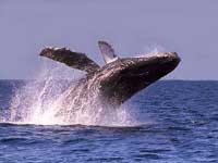
December 15th is the official “start date” for spotting of whales and dolphins swimming and playing off the coast of Mazatlán. Apparently these spectacular mammals did not get the word, as the first humpback whales have been spotted breaching in nearby waters.

Oscar Zataráin Guzón, head of Onca Explorations, said that this spectacle normally begins the later part of December, but this year the first whale was spotted on November 6th.

He added that the humpback whale is the most common of the eight whale species seen in the waters off the west coast of México, noting that the grey whale is the second most common.

Saúl Hernández, a tour guide for Onca Explorations, said that in a recent whale watching trip the tourists saw whales breaching in grandeur. He said that two were males showing off their prowess to a nearby observant female.

(from El Debate)


Thursday, September 19, 2013

Sports Fishermen Capture 330 Kilo Blue Marlin

Sports fishermen aboard the “Go Tequila” boat brought in a 300 kilo (727 pound) Blue Marlin last Saturday, considered to be one of the biggest marlins caught off Mazatlán shores in the past 40 years.

It was hooked 33 nautical miles from La Marina and, according to those on board, it took 20 minutes to land with the help of crew members.

(from Noroeste)

Thursday, September 12, 2013

Inicia el sábado la zafra camaronera en altamar

A dos días de que se levante la veda del camarón en altamar, 431 de las 530 embarcaciones que integran la flota camaronera de Mazatlán ya cuentan con el certificado para excluidores de tortuga
 
Verenice Peraza
 noroeste.com
12-09-2013


En los muelles del parque Bonfil se realizan las últimas reparaciones a los camaroneros.
Fotografía: Noroeste / Juvencio Villanueva.


MAZATLÁN._ A dos días de que se levante la veda del camarón en altamar, 431 de las 530 embarcaciones que integran la flota camaronera de Mazatlán ya cuentan con el certificado para excluidores de tortuga que exige la Norma 059 para la protección de esta especie, dio a conocer Maximiliano Hernández Torres.

El coordinador de la Procuraduría Federal de Protección al Ambiente en la zona sur del estado expresó que entre hoy y mañana, otros 40 camaroneros iniciarán el tramite de "última hora".

Sin esta certificación, es imposible que obtengan el despacho vía a la pesca por parte de Capitanía de Puerto, recalcó.

"De los 100 camaroneros que están pendiente del trámite, de acuerdo al padrón de 2012, podemos decir que más de 50 podrían no salir, o salir tarde al primer viaje, algunos de ellos por la incosteabilidad de la pesca, porque se les venció el permiso o simplemente porque se acogieron al programa Retiro Voluntario de la Conapesca".

Hernández Torres aclaró que previo a la apertura de la veda, la única dependencia que tiene a su cargo la certificación de embarcaciones es la Profepa.

Ni Conapesca, menos la Secretaría de Marina, pueden hacerlo (certificar), su participación inicia una vez abierta la veda y en altamar, durante los operativos de inspección, recalcó.

Ricardo Michel Luna, presidente de la Unión de Armadores del Litoral del Pacífico, dijo desconocer el número exacto de camaroneros que se quedarán amarrados en los muelles del Bonfil, ya que será hasta después del 15 de septiembre cuando se tendrán cifras reales de esta situación.

Reconoció que la crisis del sector pesquero sí ha golpeado a los armadores.

"Lo que sucede es que muchas pesqueras tenían vencidos los permisos para pescar, realizaron el trámite ante Conapesca y aún no les entregan el nuevo permiso, no tengo la cifra exacta, pero después del 15 de septiembre todavía estarán saliendo barcos a pescar, pueden a salir el 16 ó 17 (de septiembre)".

El líder pesquero agregó que el Retiro Voluntario no es una opción de ayuda a la que muy fácilmente se acogen los armadores.

530

Embarcaciones conforman la flota camaronera de Mazatlán

431

Camaroneros ya están certificados por Profepa, listos para salir

$1.3 millones

Se paga por cada embarcación acogida al programa Retiro Voluntario de la Conapesca 


Monday, September 2, 2013

Shrimp Season Opens September 15th


 Posted by Maureen Dietrich on 31 Aug 13
mazmessenger.com
 

The 2013-2014 shrimp fishing season for Sinaloa ocean shrimpers begins at midnight on September 15th.
Beginning September 6th at 8am, estuaries will be open for shrimp fishing.

At a meeting of the National Moratorium Committee yesterday in Mexico City, ocean shrimpers warned that if estuary fishermen did not respect the law and begin harvesting before September 6th, they would not sit idly by. Estuary shrimpers proposed they begin on September 3rd or 4th, a proposal that was not accepted.

“It was agreed that if they (estuary fishermen) violate the moratorium, the high seas boats will head out to sea (earlier).”

 (from Noroeste)

Tuesday, July 2, 2013

Mexico highway leapfrogs drug lands to link 2 seas


Posted: Sunday, June 30, 2013 10:45 am | Updated: 12:01 pm, Sun Jun 30, 2013.


Lavender-blue peaks of the western Sierra Madre jut as far as the eye can see, the only hints of civilization: a tendril of smoke from burning corn residue, a squiggle of dirt road.

Then out of nowhere, a flat ribbon of concrete runs like a roller coaster over giant pylons, burrowing in and out of the mountainside until it seems to leap midair over a 400-meter (1,200-foot) river gorge via the world's highest cable-stayed bridge, called the Baluarte.

The Durango-Mazatlan Highway is one of Mexico's greatest engineering feats, 115 bridges and 61 tunnels designed to bring people, cargo and legitimate commerce safely through a mountain range known until now for marijuana, opium poppies and an accident-prone road called the Devil's Backbone.

Even those protesting the project say the 230-kilometer-long (140-mile) highway, expected to be completed in August, will change northern Mexico dramatically for the good. It will link port cities on the Gulf of Mexico and the Pacific by a mere 12-hour drive, and Mazatlan with San Antonio, Texas, in about the same time. The highway will eventually move 5 million vehicles a year, more than four times the number on the old road, plus more produce and goods from Asia to the Mexican interior and southern U.S.

Sinaloa state tourism officials predict an "explosion" for the resort city of Mazatlan, hard hit by drug violence in recent years, as the new road gives 40 million Mexicans in interior states an easy drive to the beach.

"It will change the landscape of this part of the country," said Tourism Secretary Francisco Cordova. "It's an opportunity to develop these areas and diversify the local economy."

But it remains to be seen if the $2.2 billion highway will pull the towns of wood and corrugated-metal shacks in rural Sinaloa and Durango away from their historical ties to drug trafficking. In Concordia, the municipality that abuts the Baluarte Bridge in Sinaloa state, nine people were ambushed and killed last December as they ate their Christmas Eve dinner. The prosecutor blamed the attack on a war for control of drug trafficking.

The public security chief in Pueblo Nuevo, on the Durango side of the bridge, was gunned down a year ago by armed commandos as he walked down a street in daylight.

Government officials say the new road will bring legitimate economic activity to a troubled area. Locals say it may improve access, or take what little honest business they had as trucks and buses bypass towns altogether.

"It could leave some of the communities even more isolated," said Jose Luis Coria Quinones, spokesman for 1,800 communal tree farmers, who have an injunction suspending construction on the Durango side near the bridge while a court considers their case. They say that the federal government hasn't paid them sufficiently for access to their property during the construction and hasn't repaired the damage caused to pine forests, water supplies and endangered species habitat.

From a distance, the Baluarte Bridge and its triangular web of steel cables are both spectacular and wildly out of place, a Golden Gate Bridge in the middle of a moonscape. While shorter than the Golden Gate, the Baluarte crosses a canyon deep enough to fit the Chrysler Building.

Engineers pump their fists when asked who designed it: "Puros Mexicanos." All Mexicans.

A team of 60 to 80 experts started about 15 years ago in the Secretary of Communications and Transportation offices in Mexico City, said supervising architect Alberto Ortiz Martinez, using horseback, mule and helicopter to scope out possible routes. The entire road took 130,000 tons of steel and more than 20 times the concrete of an Olympic stadium.

Some 1,200 workers on the bridge lived for four years in a nearby encampment.

"The most complicated problem was getting there, to locations totally inaccessible, and bringing huge quantities of materials," said engineer Jose Refugio Avila Muro, a federal subdirector of highway projects for Sinaloa state. He compared the topography to an electrocardiogram: "Lots of peaks, and you have to find a way to get to each peak from below. You just keep going, one by one, to each new point of construction."

The new highway will cut the drive between Durango and Mazatlan to 2.5 hours from the current six hours of hairpin turns, few guard rails and the Devil's Backbone, a stretch of road along the spine of a mountain with drops of hundreds of meters (feet) on either side.

Coming around a blind curve, a driver may suddenly have to negotiate passage between a semitrailer barreling downhill and a handful of cows tiptoeing along a narrow shoulder. Deadly accidents are common. A bus carrying mostly retiree tourists to Mazatlan plunged off the road a year ago, killing a dozen and injuring 22.

But the old highway is not the most forbidding part of the landscape.

From December 2006 until September 2011, when the federal government stopped providing numbers, Sinaloa and Durango on either side of the Baluarte Bridge were among the deadliest states in terms of drug-related killings. Mazatlan ranked 8th among Mexico's more than 2,400 municipalities and Pueblo Nuevo, the municipality on the Durango side of the highway, was 35th most violent up to the end of 2010.

The U.S. State Department discourages travel in both states, except for specific tourist zones of Mazatlan
.
The killings spiked in townships near the new road as a group known as the Mazatlecos and the Zetas battle for territory controlled by the Sinaloa Cartel, named for its home state and headed by Joaquin "El Chapo" Guzman, the world's richest and most-wanted drug lord. A series of attacks around Concordia, Sinaloa, in late 2012, including the Christmas Eve massacre, caused some 250 families to flee their communities, said Concordia Mayor Eligio Medina. They have yet to move back.

Medina said the new highway could change the criminal dynamic, bringing tourism to colonial Concordia, founded in 1565 by the Spaniards as a way station between the coast and the gold mines.

It's also one of the most biologically diverse townships in the world, he said, noting that a new species of plant, the ageratina concordiana, was recently discovered there. He envisions everything from bird-watching to bungee jumping in Concordia's Chara Pinta ecological preserve.

"The road will increase jobs and keep people busy," Medina said. "When there is social mobility, criminal groups are more limited."

Medina said the area is quiet again, with the Mexican military patrolling the towns that were attacked. Mazatlan tourism officials say killings there have dropped from 307 in 2011 to 43 so far this year. Latin America security expert Samuel Logan agrees the new road could be a boost to tourism and commerce, and but also to illegal transport.

"Maybe Concordia will grow and there will be a Holiday Inn Express there," he said. "Will there be running daytime shootouts on this highway? Not likely. But will there be convoys of eight to 10 trucks going 90 mph (140 kph) filled with guys with guns? Probably."


Monday, June 10, 2013

Hurricane Readiness

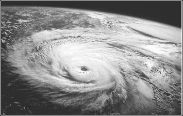
Satellite image of a hurricane
 
 
A hurricane is a type of tropical cyclone, the generic term for a low pressure system that generally forms in the tropics. A typical cyclone is accompanied by thunderstorms, and in the Northern Hemisphere, a counterclockwise circulation of winds near the earths surface.
 
All Atlantic and Gulf of Mexico coastal areas are subject to hurricanes or tropical storms. Parts of the Southwest United States and the Pacific Coast experience heavy rains and floods each year from hurricanes spawned off Mexico. The Atlantic hurricane season lasts from June to November, with the peak season from mid-August to late October.

Hurricanes can cause catastrophic damage to coastlines and several hundred miles inland. Winds can exceed 155 miles per hour. Hurricanes and tropical storms can also spawn tornadoes and microbursts, create storm surges along the coast, and cause extensive damage from heavy rainfall.

Hurricanes are classified into five categories based on their wind speed, central pressure, and damage potential (see chart). Category Three and higher hurricanes are considered major hurricanes, though Categories One and Two are still extremely dangerous and warrant your full attention.


Saffir-Simpson Hurricane Scale
 
Scale Number (Category) Sustained Winds (MPH) Damage Storm Surge
174-95Minimal: Unanchored mobile homes, vegetation and signs.4-5 feet
296-110Moderate: All mobile homes, roofs, small crafts, flooding.6-8 feet
3111-130Extensive: Small buildings, low-lying roads cut off.9-12 feet
4131-155Extreme: Roofs destroyed, trees down, roads cut off, mobile homes destroyed. Beach homes flooded.13-18 feet
5More than 155Catastrophic: Most buildings destroyed. Vegetation destroyed. Major roads cut off. Homes flooded.Greater than 18 feet


Hurricanes can produce widespread torrential rains. Floods are the deadly and destructive result.

Slow moving storms and tropical storms moving into mountainous regions tend to produce especially heavy rain. Excessive rain can trigger landslides or mud slides, especially in mountainous regions.

Flash flooding can occur due to intense rainfall. Flooding on rivers and streams may persist for several days or more after the storm.

Between 1970 and 1999, more people lost their lives from freshwater inland flooding associated with land falling tropical cyclones than from any other weather hazard related to tropical cyclones.


Naming the Hurricanes

Since 1953, Atlantic tropical storms have been named from lists originated by the National Hurricane Center and now maintained and updated by an international committee of the World Meteorological Organization. The lists featured only women's names until 1979. After that, men's and women's names were alternated. Six lists are used in rotation. Thus, the 2001 lists will be used again in 2007.

The only time there is a change in the list is if a storm is so deadly or costly that the continued use of the name would be inappropriate for reasons of sensitivity. When this occurs, the name is stricken from the list and another name is selected to replace it.


Know the Terms

Familiarize yourself with these terms to help identify a hurricane hazard:
  • Tropical Depression: An organized system of clouds and thunderstorms with a defined surface circulation and maximum sustained winds of 38 MPH (33 knots) or less. Sustained winds are defined as one-minute average wind measured at about 33 ft (10 meters) above the surface.
  • Tropical Storm: An organized system of strong thunderstorms with a defined surface circulation and maximum sustained winds of 3973 MPH (3463 knots).
  • Hurricane: An intense tropical weather system of strong thunderstorms with a well-defined surface circulation and maximum sustained winds of 74 MPH (64 knots) or higher.
  • Storm Surge: A dome of water pushed onshore by hurricane and tropical storm winds. Storm surges can reach 25 feet high and be 501000 miles wide.
  • Storm Tide: A combination of storm surge and the normal tide (i.e., a 15-foot storm surge combined with a 2-foot normal high tide over the mean sea level created a 17-foot storm tide).
  • Hurricane/Tropical Storm Watch: Hurricane/tropical storm conditions are possible in the specified area, usually within 36 hours. Tune in to NOAA Weather Radio, commercial radio, or television for information.
  • Hurricane/Tropical Storm Warning: Hurricane/tropical storm conditions are expected in the specified area, usually within 24 hours.
  • Short Term Watches and Warnings: These warnings provide detailed information about specific hurricane threats, such as flash floods and tornadoes.

Take Protective Measures

Before a Hurricane

To prepare for a hurricane, you should take the following measures:
  • Make plans to secure your property. Permanent storm shutters offer the best protection for windows. A second option is to board up windows with 5/8 marine plywood, cut to fit and ready to install. Tape does not prevent windows from breaking.
  • Install straps or additional clips to securely fasten your roof to the frame structure. This will reduce roof damage.
  • Be sure trees and shrubs around your home are well trimmed.
  • Clear loose and clogged rain gutters and downspouts.
  • Determine how and where to secure your boat.
  • Consider building a safe room.

Hurricane Emergency Supplies List

Your home should be stocked with supplies that may be needed during the hurricane emergency period. The CDC recommends that at a minimum, these supplies should include:
  • Several clean containers for water, large enough for a 3-5 day supply of water (about five gallons for each person).
  • Non-perishable food-A 3-5 day supply.
  • A first aid kit and manual.
  • A battery-powered radio, flashlights, and extra batteries.
  • Sleeping bags or extra blankets.
  • Water-purifying supplies, such as chlorine or iodine tablets or unscented, ordinary household chlorine bleach.
  • Prescription medicines and special medical needs.
  • Baby food and/or prepared formula, diapers, and other baby supplies.
  • Disposable cleaning cloths, such as "baby wipes" for the whole family to use in case bathing facilities are not available.
  • Personal hygiene supplies, such as soap, toothpaste, sanitary napkins, etc.
  • An emergency kit for your car with food, flares, booster cables, maps, tools, a first aid kit, fire extinguisher, sleeping bags, etc.

During a Hurricane

If a hurricane is likely in your area, you should:
  • Listen to the radio or TV for information.
  • Secure your home, close storm shutters, and secure outdoor objects or bring them indoors.
  • Turn off utilities if instructed to do so. Otherwise, turn the refrigerator thermostat to its coldest setting and keep its doors closed.
  • Turn off propane tanks. Avoid using the phone, except for serious emergencies.
  • Moor your boat if time permits.
  • Ensure a supply of water for sanitary purposes such as cleaning and flushing toilets. Fill the bathtub and other large containers with water.
You should evacuate under the following conditions:
  • If you are directed by local authorities to do so. Be sure to follow their instructions.
  • If you live in a mobile home or temporary structure such shelters are particularly hazardous during hurricanes no matter how well fastened to the ground.
  • If you live in a high-rise building, hurricane winds are stronger at higher elevations.
  • If you live on the coast, on a floodplain, near a river, or on an inland waterway.
  • If you feel you are in danger.
If you are unable to evacuate, go to your wind-safe room. If you do not have one, follow these guidelines:
  • Stay indoors during the hurricane and away from windows and glass doors.
  • Close all interior doors, secure and brace external doors.
  • Keep curtains and blinds closed. Do not be fooled if there is a lull; it could be the eye of the storm - winds will pick up again.
  • Take refuge in a small interior room, closet, or hallway on the lowest level.
  • Lie on the floor under a table or another sturdy object.


Hurricane Season 2013

NOAA PRESS RELEASE
NOAA: 2013 Eastern Pacific Hurricane Season Outlook
 
Issued: 23 May 2013
 
Realtime monitoring of tropical East Pacific conditions can be obtained here
Realtime monitoring of tropical Atlantic conditions can be obtained here
The 2013 eastern Pacific hurricane season outlook is an official product of the National Oceanic and Atmospheric Administration (NOAA) Climate Prediction Center (CPC), and is produced in collaboration with scientists from the NOAA National Hurricane Center (NHC). The eastern Pacific hurricane region covers the eastern North Pacific Ocean east of 140°W north of the equator.
 
Interpretation of NOAA’s eastern Pacific hurricane season outlook
This outlook is general guide to the expected overall activity during the upcoming hurricane season. It is not a seasonal hurricane landfall forecast, and it does not imply levels of activity for any particular region.
 
Preparedness

Hurricane disasters can occur whether the season is active or relatively quiet. It only takes one hurricane (or even a tropical storm) to cause a disaster. Therefore, residents, businesses, and government agencies of coastal and near-coastal regions are urged to prepare for every hurricane season regardless of this, or any other, seasonal outlook. NOAA, the Federal Emergency Management Agency (FEMA), the NHC, the Small Business Administration, and the American Red Cross all provide important hurricane preparedness information on their web sites.

NOAA does not make seasonal hurricane landfall predictions

NOAA does not make seasonal hurricane landfall predictions. Hurricane landfalls are largely determined by the weather patterns in place as the hurricane approaches, which are only predictable when the storm is within several days of making landfall.
 

Nature of this Outlook and the “likely” ranges of activity

This outlook is probabilistic, meaning the stated “likely” ranges of activity have a certain likelihood of occurring. The seasonal activity is expected to fall within these ranges in 7 out of 10 seasons with similar climate conditions and uncertainties to those expected this year. They do not represent the total possible ranges of activity seen in past similar years.

This outlook is based on predictions of large-scale climate factors and conditions known to strongly influence seasonal eastern Pacific hurricane activity, along with climate model forecasts. The outlook also takes into account uncertainties inherent in such climate outlooks.

Sources of uncertainty in this seasonal outlook


  1. Predicting El Niño and La Niña (also called ENSO) impacts is an ongoing scientific challenge facing climate scientists today. Such forecasts made during the spring generally have limited skill.
  2. Many combinations of named storms and hurricanes can occur for the same general set of climate conditions. For example, one cannot know with certainty whether a given climate signal will be associated with several short-lived storms or fewer longer-lived storms with greater intensity.
  3. Weather patterns that are unpredictable on seasonal time scales can sometimes develop and last for weeks or months, possibly affecting seasonal hurricane activity.


2013 Eastern Pacific Hurricane Outlook Summary
 
 
NOAA’s 2013 eastern Pacific Hurricane Season Outlook indicates a 55% chance of a below-normal season, a 35% chance of a near-normal season, and a 10% chance of an above normal season. See NOAA definitions of above, near-, and below- normal seasons. The eastern Pacific hurricane region covers the eastern North Pacific Ocean east of 140oW north of the equator.
 
This outlook is based on the analysis and prediction of three climate signals:
 
 
Historically, these conditions tend to suppress eastern Pacific hurricane activity. We estimate a 70% chance of occurrence for each of the following ranges of activity this season:
 
  • 11-16 named storms,
  • 5-8 hurricanes,
  • 1-4 major hurricanes,
  • An ACE range 60%-105% of the median.
 
The seasonal activity is expected to fall within these ranges in 7 out of 10 seasons with similar climate conditions and uncertainties to those expected this year. They do not represent the total possible ranges of activity seen in past similar years.
 
Note that the predicted ranges are centered below the official NHC 1981-2010 seasonal averages of 15 named storms, 8 hurricanes, and 4 major hurricanes.
 
There will be no further updates to this outlook.
 
 
DISCUSSION
 
1. Expected 2013 Activity
This Outlook is a general guide to the expected overall activity for the 2013 eastern Pacific hurricane season. It is not a seasonal hurricane landfall forecast, and it does not imply levels of activity for any particular location.
 
Known climate signals and evolving oceanic and atmospheric conditions, combined with dynamical model forecasts, indicate that a below-normal 2013 eastern Pacific hurricane season is most likely. This outlook calls for a 55% chance of a below-normal season, a 35% chance of a near-normal season, and a 10% chance of an above-normal season.
An important measure of the total seasonal activity is NOAA’s Accumulated Cyclone Energy (ACE) index, which accounts for the combined strength and duration of tropical storms and hurricanes during the season. We estimate a 70% chance that the 2013 seasonal ACE index will be in the range of 60%-105% of the median. According to NOAA’s definitions of season strength, an ACE value below 80% of the 1981-2010 median indicates a below normal season, and a value of 80%-115% of the median indicates a near-normal season.
 
Consistent with the expected ACE range, other likely (70% chance) ranges of activity for 2013 are 11-16 named storms, 5-8 hurricanes, and 1-4 major hurricanes.
This outlook is consistent with climate model forecasts. Predictions from NOAA’s Climate Forecast System (CFS), the European Centre for Medium Range Weather Forecasting (ECMWF), and the EUROpean Seasonal to Inter-annual Prediction (EUROSIP) ensemble are all suggesting below-normal or near-normal tropical cyclone activity in the eastern Pacific this season, though their forecast skill for the region is limited at this lead time.
 
2. Science behind the outlook
 
This outlook is based on the analysis and prediction of three climate signals. The first is a continuation of conditions that have been suppressing eastern Pacific hurricane activity since 1995. The second is a likely continuation of ENSO-neutral conditions through the season. The third is an expectation for near- or below-average sea-surface temperatures in the Niño-3 region of the eastern tropical Pacific Ocean. SSTs in this region are an additional predictor for eastern Pacific hurricane activity, especially in the presence of ENSO-neutral conditions.
 
a. Expected continuation of low-activity hurricane era in the eastern Pacific
East Pacific hurricane seasons have been less active since 1995, while the Atlantic Basin has experienced increased activity. During 1995-2012, 39% of eastern Pacific hurricane seasons were below normal, 39% were near normal, and only 22% were above normal. Seasons during this period averaged about 13 named storms, 7 hurricanes, and 3 major hurricanes, with an ACE value of 88% of the median.
 
Associated with the climate conditions that have contributed to this reduction in eastern Pacific hurricane activity, the Pacific Inter-Tropical Convergence Zone (ITCZ) has been shifted farther north, allowing for extensive southwesterly flow into the eastern tropical North Pacific. Also, the upper-level ridge over Mexico has been stronger than average, resulting in enhanced upper-level easterly winds. This combination of factors leads to increased vertical wind shear, which typically limits the number, intensity, and duration of tropical storms and hurricanes. Also, these storms tend to form closer to Mexico and closer to cooler ocean temperatures, both of which limit their duration.
The levels of hurricane activity since 1995 in the eastern Pacific (and the Atlantic basin) contrast sharply with those of the preceding period 1982-1994. The eastern Pacific was much more active during this earlier period, while the Atlantic basin was more suppressed. For the eastern Pacific, 62% of hurricane seasons during 1982-1994 were above normal, 23% were near normal, and only 15% were below normal. Seasons during this period averaged about 18 named storms, 10.5 hurricanes, and 5 major hurricanes, with an ACE value of 150% of the median. This average value falls within NOAA’s definition for an above-normal season.
 
b. ENSO-neutral conditions
The ENSO (El Niño/ Southern Oscillation) is an important climate predictor for eastern Pacific hurricane activity. The three phases of ENSO are El Niño, La Niña, and Neutral. El Niño acts to reduce the vertical wind shear, and is therefore more conducive to eastern Pacific hurricane activity. Conversely, La Niña increases the wind shear and usually suppresses the activity. These typical impacts can be strongly modulated by conditions associated with the tropical multi-decadal signal.
SSTs in the eastern equatorial Pacific (i.e. the Niño-3 region) are also used to predict seasonal eastern Pacific hurricane activity, especially in the presence of ENSO-neutral conditions.
 
ENSO-neutral conditions have been present since last summer. Currently, equatorial Pacific SSTs are near average and the Niño 3.4 index is slightly below zero. The equatorial Pacific sub-surface temperatures and oceanic heat content are also near average.
 
Most models contained in the suite of IRI/ CPC Niño 3.4 SST forecasts predict ENSO-neutral conditions to continue through ASO, with the statistical model forecasts being generally cooler than the dynamical model forecasts. The CFS T-382 high-resolution model predicts La Niña for ASO, which is consistent with its forecast for increased vertical wind shear across the eastern tropical Pacific.
 
The observations, ENSO model forecasts, the official CPC/IRI ENSO forecast issued in early May, all suggest that ENSO-Neutral conditions are likely to continue through the summer and fall (55% chance). El Niño is not expected to develop this summer and enhanced the seasonal activity.
NOAA FORECASTERS


Climate Prediction Center
Dr. Gerald Bell, Meteorologist, Gerry.Bell@noaa.gov
Dr. Jae Schemm, Meteorologist, Jae.Schemm@noaa.gov

National Hurricane Center
Eric Blake, Hurricane Specialist, Eric.S.Blake@noaa.gov
Todd Kimberlain, Hurricane Specialist, Todd.Kimberlain@noaa.gov

Dr. Christopher Landsea, Meteorologist, Chris.Landsea@noaa.gov 


2013 Hurricane Names

Alvin
Barbara
Cosme
Dalila
Erick
Flossie
Gil
Henriette
Ivo
Juliette
Kiko
Lorena
Manuel
Narda
Octave
Priscilla
Raymond
Sonia
Tico
Velma
Wallis
Xina
York
Zelda