The 2013 eastern Pacific
hurricane season outlook is an official product of the National Oceanic and
Atmospheric Administration (NOAA) Climate Prediction Center (CPC), and is
produced in collaboration with scientists from the NOAA National Hurricane
Center (NHC). The eastern Pacific hurricane region covers the eastern North
Pacific Ocean east of 140°W north of the equator.
Interpretation of
NOAA’s eastern Pacific hurricane season outlook
This outlook is
general guide to the expected overall activity during the upcoming hurricane
season. It is not a seasonal hurricane landfall forecast, and it does not imply
levels of activity for any particular region.
Preparedness
Hurricane disasters
can occur whether the season is active or relatively quiet. It only takes one
hurricane (or even a tropical storm) to cause a disaster. Therefore, residents,
businesses, and government agencies of coastal and near-coastal regions are
urged to prepare for every hurricane season regardless of this, or any other,
seasonal outlook. NOAA, the Federal Emergency Management Agency (FEMA), the NHC,
the Small Business Administration, and the American Red Cross all provide
important hurricane preparedness information on their web sites.
NOAA does not make seasonal
hurricane landfall predictions
NOAA does not make seasonal hurricane
landfall predictions. Hurricane landfalls are largely determined by the weather
patterns in place as the hurricane approaches, which are only predictable when
the storm is within several days of making landfall.
Nature of this Outlook and the
“likely” ranges of activity
This outlook is probabilistic, meaning
the stated “likely” ranges of activity have a certain likelihood of occurring.
The seasonal activity is expected to fall within these ranges in 7 out of 10
seasons with similar climate conditions and uncertainties to those expected this
year. They do not represent the total possible ranges of activity seen in past
similar years.
This outlook is based on predictions of large-scale
climate factors and conditions known to strongly influence seasonal eastern
Pacific hurricane activity, along with climate model forecasts. The outlook also
takes into account uncertainties inherent in such climate outlooks.
Sources of uncertainty in this
seasonal outlook
- Predicting El Niño and La Niña (also
called ENSO) impacts is an ongoing scientific challenge facing climate
scientists today. Such forecasts made during the spring generally have limited
skill.
- Many combinations of named storms and
hurricanes can occur for the same general set of climate conditions. For
example, one cannot know with certainty whether a given climate signal will be
associated with several short-lived storms or fewer longer-lived storms with
greater intensity.
- Weather patterns that are
unpredictable on seasonal time scales can sometimes develop and last for weeks
or months, possibly affecting seasonal hurricane activity.
2013 Eastern Pacific
Hurricane Outlook Summary
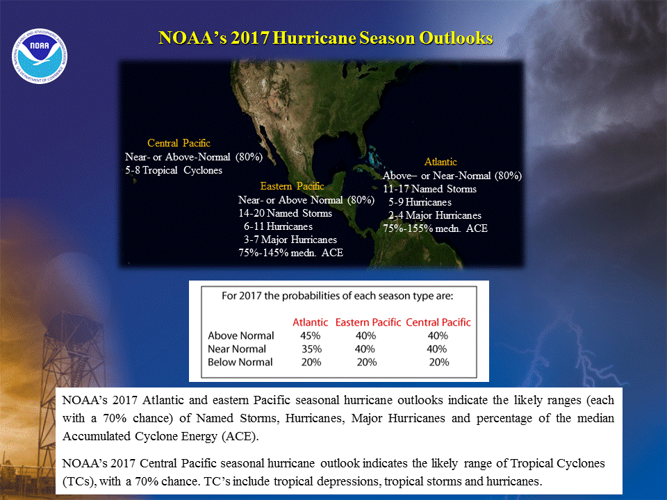
NOAA’s 2013 eastern Pacific Hurricane Season Outlook indicates a
55% chance of a below-normal season, a 35% chance of a near-normal season, and a
10% chance of an above normal season. See NOAA definitions of above, near-, and
below- normal seasons. The eastern Pacific hurricane region covers the eastern
North Pacific Ocean east of 140oW north of the equator.
This outlook is based on the
analysis and prediction of three climate signals:
Historically, these conditions
tend to suppress eastern Pacific hurricane activity. We estimate a 70% chance of
occurrence for each of the following ranges of activity this season:
- 11-16 named storms,
- 5-8 hurricanes,
- 1-4 major hurricanes,
- An ACE range 60%-105% of the median.
The seasonal activity is
expected to fall within these ranges in 7 out of 10 seasons with similar climate
conditions and uncertainties to those expected this year. They do not represent
the total possible ranges of activity seen in past similar years.
Note that the predicted ranges
are centered below the official NHC 1981-2010 seasonal averages of 15 named
storms, 8 hurricanes, and 4 major hurricanes.
There will be no further
updates to this outlook.
DISCUSSION
1. Expected 2013
Activity
This Outlook is a general guide
to the expected overall activity for the 2013 eastern Pacific hurricane season.
It is not a seasonal hurricane landfall forecast, and it does not imply levels
of activity for any particular location.
Known climate signals and
evolving oceanic and atmospheric conditions, combined with dynamical model
forecasts, indicate that a below-normal 2013 eastern Pacific hurricane season is
most likely. This outlook calls for a 55% chance of a below-normal season, a 35%
chance of a near-normal season, and a 10% chance of an above-normal season.
An important measure of the
total seasonal activity is NOAA’s Accumulated
Cyclone Energy (ACE) index, which accounts for the combined
strength and duration of tropical storms and hurricanes during the season. We
estimate a 70% chance that the 2013 seasonal ACE index will be in the range of
60%-105% of the median. According to NOAA’s definitions of season strength, an
ACE value below 80% of the 1981-2010 median indicates a below normal season, and
a value of 80%-115% of the median indicates a near-normal season.
This outlook is consistent with
climate model forecasts. Predictions from NOAA’s Climate Forecast System (CFS),
the European Centre for Medium Range Weather Forecasting (ECMWF), and the
EUROpean Seasonal to Inter-annual Prediction (EUROSIP) ensemble are all
suggesting below-normal or near-normal tropical cyclone activity in the eastern
Pacific this season, though their forecast skill for the region is limited at
this lead time.
2. Science behind the
outlook
a. Expected continuation of
low-activity hurricane era in the eastern Pacific
East Pacific hurricane seasons
have been less active since 1995, while the Atlantic Basin has experienced
increased activity. During 1995-2012, 39% of eastern Pacific hurricane seasons
were below normal, 39% were near normal, and only 22% were above normal. Seasons
during this period averaged about 13 named storms, 7 hurricanes, and 3 major
hurricanes, with an ACE value of 88% of the median.
Associated with the climate conditions that have contributed to this reduction in
eastern Pacific hurricane activity, the Pacific Inter-Tropical Convergence
Zone (ITCZ) has been shifted farther north, allowing for extensive southwesterly
flow into the eastern tropical North Pacific. Also, the upper-level ridge over
Mexico has been stronger than average, resulting in enhanced upper-level
easterly winds. This combination of factors leads to increased vertical wind
shear, which typically limits the number, intensity, and duration of tropical
storms and hurricanes. Also, these storms tend to form closer to Mexico and
closer to cooler ocean temperatures, both of which limit their duration.
The levels of hurricane
activity since 1995 in the eastern Pacific (and the Atlantic basin) contrast
sharply with those of the preceding period 1982-1994. The eastern Pacific was
much more active during this earlier period, while the Atlantic basin was more
suppressed. For the eastern Pacific, 62% of hurricane seasons during 1982-1994
were above normal, 23% were near normal, and only 15% were below normal. Seasons
during this period averaged about 18 named storms, 10.5 hurricanes, and 5 major
hurricanes, with an ACE value of 150% of the median. This average value falls
within NOAA’s definition for an above-normal season.
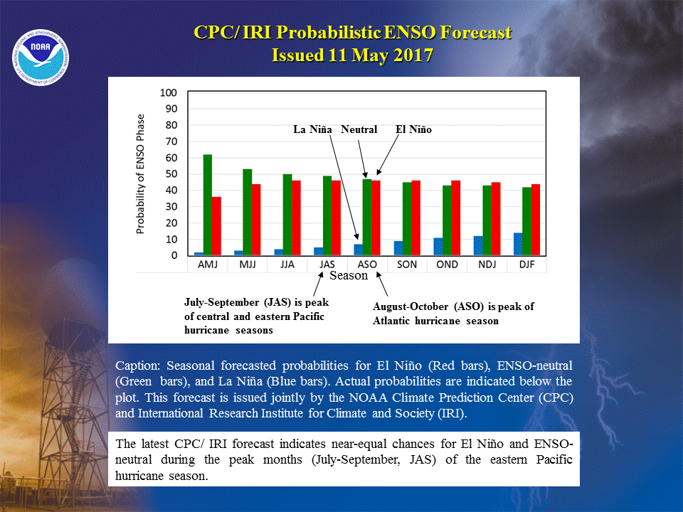
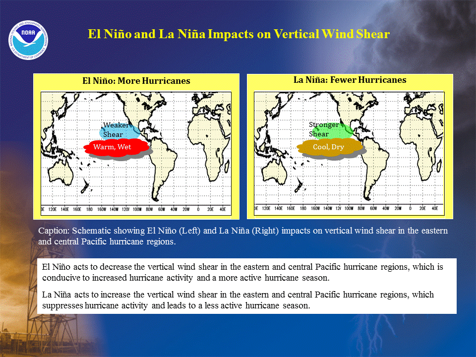
b. ENSO-neutral
conditions
The ENSO (El Niño/ Southern
Oscillation) is an important climate predictor for eastern Pacific hurricane
activity. The three phases of ENSO are El Niño, La Niña, and Neutral. El Niño
acts to reduce the vertical wind shear, and is therefore more conducive to
eastern Pacific hurricane activity. Conversely, La Niña increases the wind shear
and usually suppresses the activity. These typical impacts can be strongly
modulated by conditions associated with the tropical multi-decadal signal.
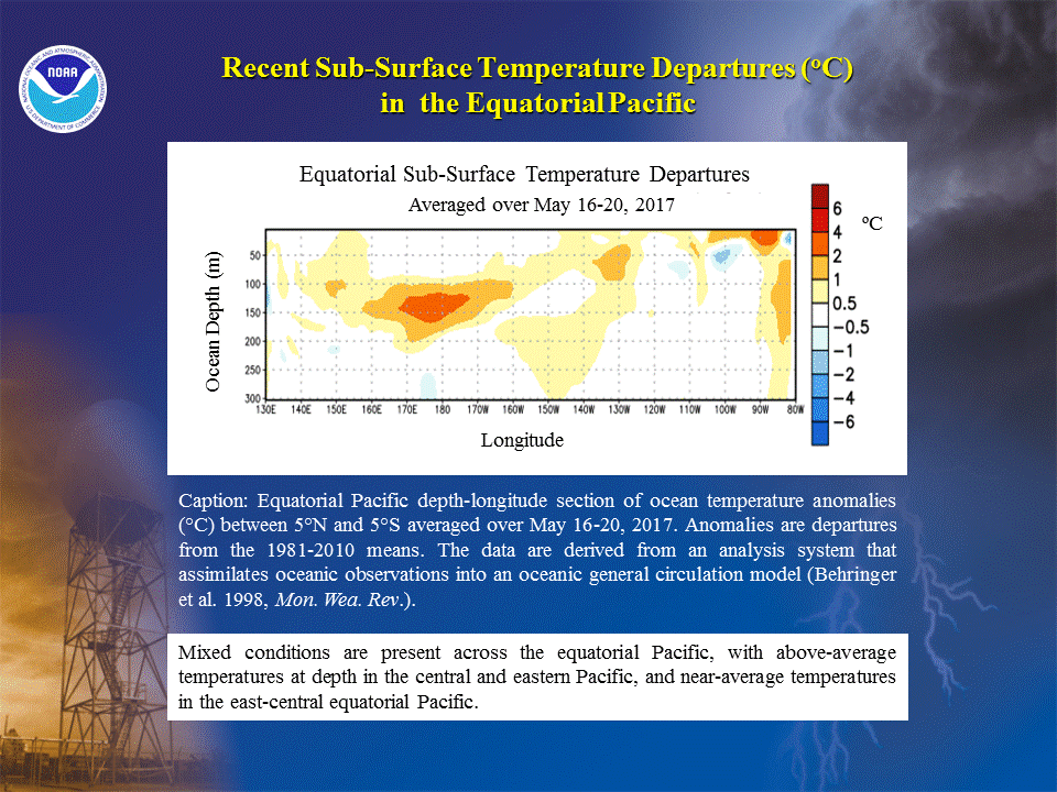
SSTs in the eastern equatorial
Pacific (i.e. the Niño-3 region) are also used to predict seasonal eastern
Pacific hurricane activity, especially in the presence of ENSO-neutral
conditions.
NOAA
FORECASTERS
Climate Prediction Center
Dr.
Gerald Bell, Meteorologist, Gerry.Bell@noaa.gov
Dr. Jae Schemm,
Meteorologist, Jae.Schemm@noaa.gov
National
Hurricane Center
Eric Blake, Hurricane Specialist, Eric.S.Blake@noaa.gov
Todd
Kimberlain, Hurricane Specialist, Todd.Kimberlain@noaa.gov
Dr.
Christopher Landsea, Meteorologist, Chris.Landsea@noaa.gov
|

No comments:
Post a Comment